Who is Edward James Powell?
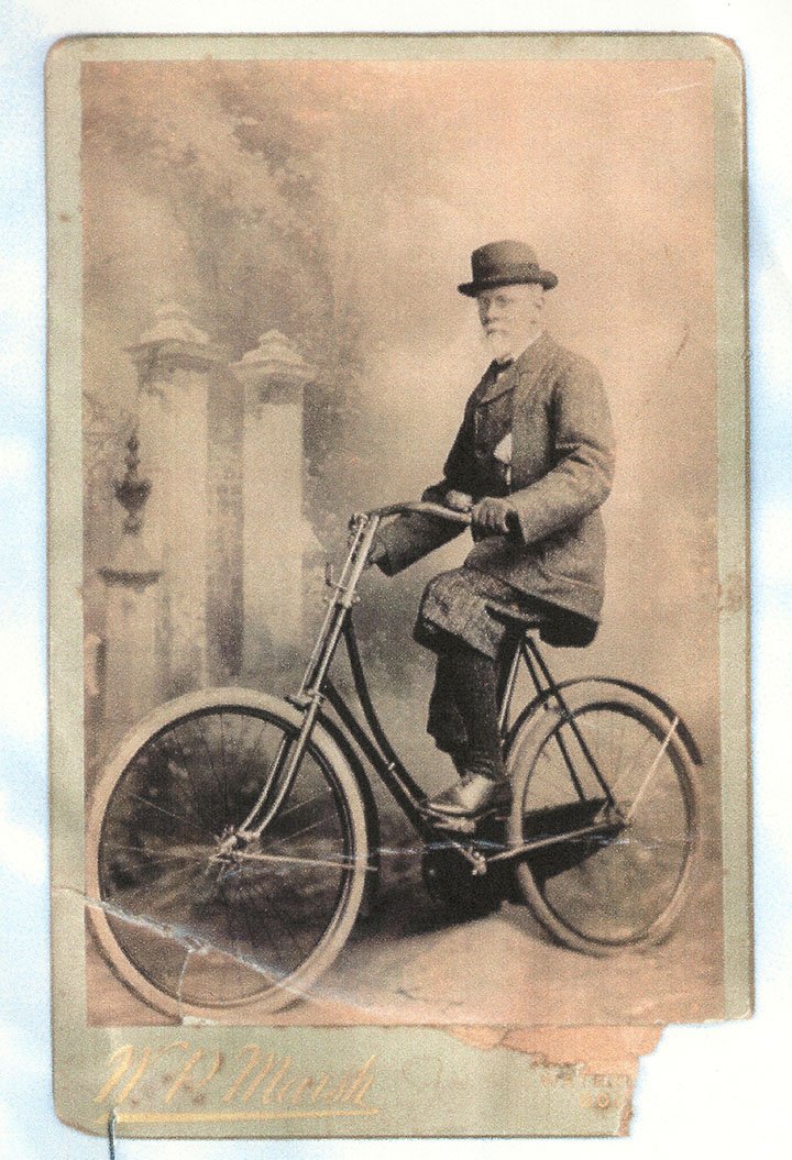
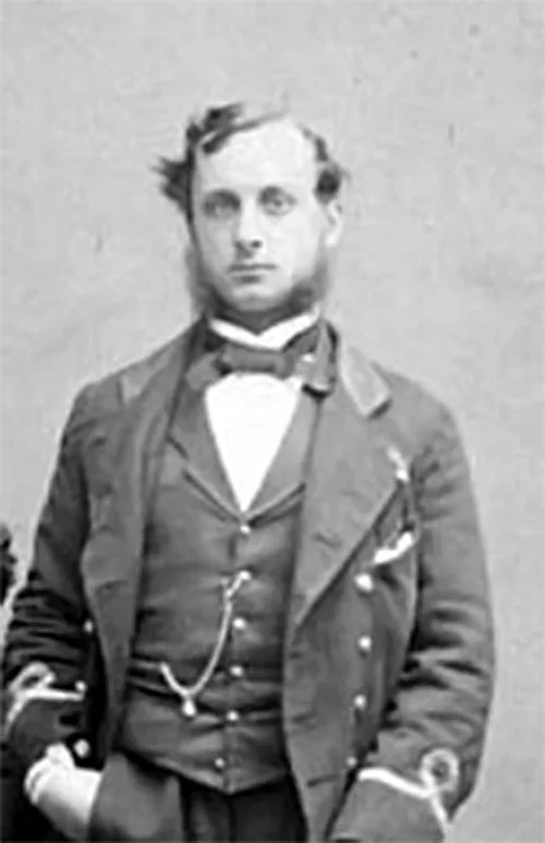
Edward James Powell, photographed by W.P. Marsh, 1890’s
Edward James Powell is one of the greatest cartographers in history; an artist and a master of the science of hydrography. Throughout his life he worked meticulously to turn the work of sailors and surveyors into beautiful charts, and was the first man to precisely map the coastline of British Columbia. To tell Edward’s story I must paint a larger picture; a story of a grand collaboration between people on different continents working together to precisely record the structure of the world. In this page I will tell Edward’s story, and the stories of three other men who made British Columbia what it is today: George Henry Richards, Daniel Pender, and John Hanmer.
Edward James Powell was born in April 1827 in Camden, Middlesex, England; the Son of John Edward Powell and Rebecca Francis ¹ . He studied at High Cross Green School in Tottenham, and first worked as an Engineer and a patent agent, developing a skill of technical drawing ². In his personal life, he married Eliza Ann Scott when he was 21, and over the next 13 years they had five children together ³.
Powell’s first known work is a drawing of screw propellers, which was displayed at the Great Exhibition of the Works of Industry of All Nations, in Hyde Park, London, in 1851 ²⸴⁴.
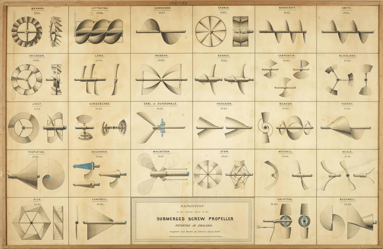
Exposition on the various forms of the Submerged Screw Propeller. Drawn by Edward James Powell, 1851
Edward’s drawing must have caught the attention of the Admiralty Hydrographic Office, as in 1852 he was given a position in the office as a scientific draughtsman ². A draughtsman (pronounced draftsman) is someone who creates technical drawings. In the Hydrographic office this work was focused on the creation of Admiralty Charts, which mapped coastlines from details provided by surveying expeditions. His first chart of Canada was of Halifax Harbour, produced in 1853 ⁵. In 1856 he created a table of charts and scales that was adopted as the official departmental tables for constructing charts ². Edward rose quickly in the ranks of the Hydrographic Office, and was promoted to second class draughtsman in 1859 ⁶⸴⁷.
Hydrographic Office Coat of Arms
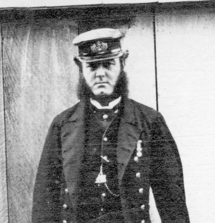
To relate the connection between Edward Powell and Powell River, we must first describe the life of Sir George Henry Richards. Richards was born in 1819 in Antony, Cornwall, and joined the Royal Navy in 1832 at the age of thirteen. He served on multiple ships in the Pacific and rose swiftly through the ranks. In 1852, he was second in command of the HMS Assistance, as the ship searched for the missing expedition of Sir John Franklin. He returned to England in 1854 and was promoted to Captain ⁸⸴⁹.
In 1856, Richards was given command of the HMS Plumper, and piloted the ship to the Pacific Station at Esquimalt Harbour in Victoria. He was tasked with making a detailed survey of the area between Vancouver Island and the mainland, to help determine the how the border between Canada and the United states would run through the San Juan Islands. This survey was conducted under tremendous pressure, as the Americans were so aggressive in their claim that they had landed troops on San Juan Island ⁸.
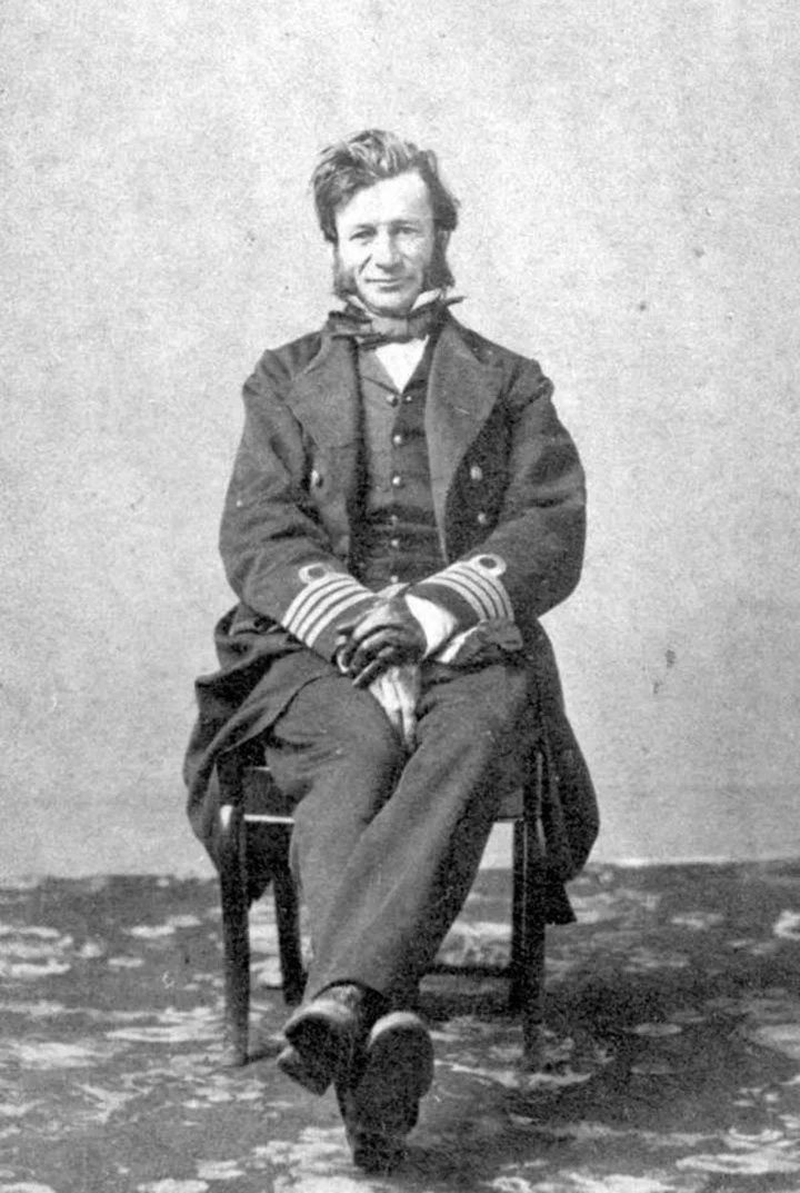
George Henry Richards
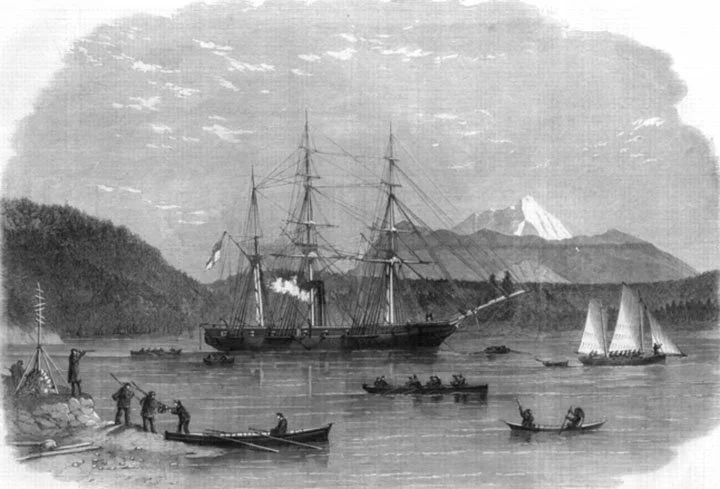
H.M.S. Plumper at Port Harvey, start of the surveying boats. Etching by Edward Bedwell.
During the process of making a survey, the Plumper would would disembark smaller boats, which would spread out and take bearings (position), soundings (depth) and make observations of reefs, shoals, points, islands, rivers and mountains. The navigating lieutenant would make a draft chart of the region, and the next time the ship docked, the notes and charts would be sent by mail to the UK Hydrographic Office. In the office, the draughtsmen would compile multiple sets of notes and draft charts, and draw a complete admiralty chart covering the entire area ¹⁰.
The time when Richards was making his surveys on the HMS Plumper would have been when he first came into communication with Edward Powell. Powell had just been promoted to second class draughtsman ⁶, and was responsible for producing the charts from Richard’s surveys. Edward Powell’s first chart of British Columbia was created in 1859, showing Haro and Rosario Straits ¹¹. This was followed by two charts of Victoria Harbour in 1859 ¹². As Richards continued making surveys in 1858 and 1859, a great volume of his notes, sketches, and correspondence passed into Edward’s hands. The two men were collaborating over a great distance to map the shores of British Columbia.
Richards documented his work in detail, and his captain’s journal and field book gives insight into his work and life on the coast. From this record, Richards is noted for his compassionate and gentle approach in his interactions with First Nations people ¹³.
As part of his surveying work, Richards gave place names to locations according to the instructions of Admiral Beaufort. Native names were to be kept wherever possible, and names of politicians were to be limited. This left Richards with latitude to give names to ships, members of his crew, colleagues, and people he knew personally ¹⁴.
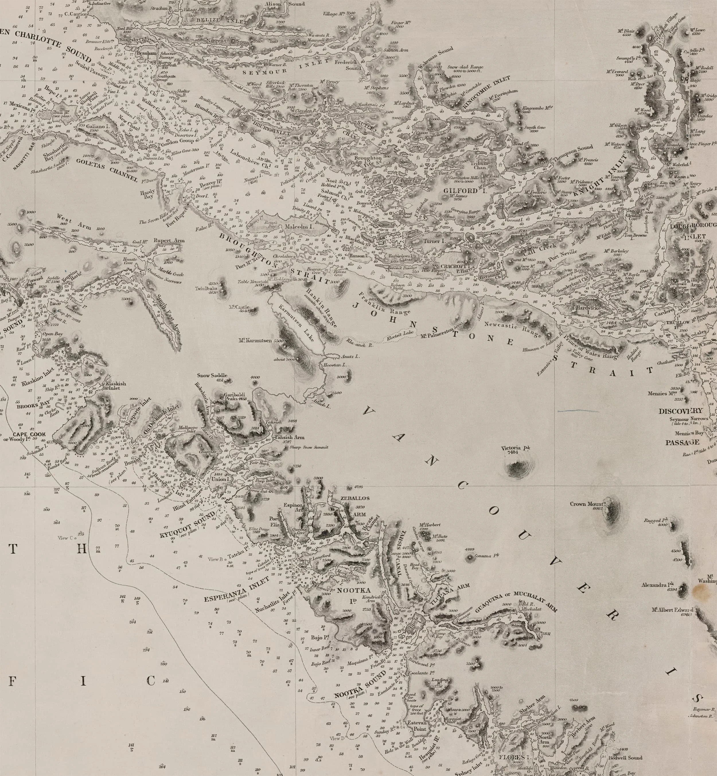
Chart 2689 Drawn by Edward Powell, 1859
Beaufort’s instructions had an important consequence for the work of G.H. Richards and Edward Powell over the next decade; the documentation of hundreds of Indigenous place names. As the crew of the Hecate traveled the coast they learned place names from local people and recorded them in draft charts. These names were included as official records by Edward Powell in the charts he drew at the Hydrographic Office. As the charts were published and distributed, these names entered the lexicon of sailors as they navigated the coast.
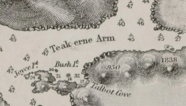
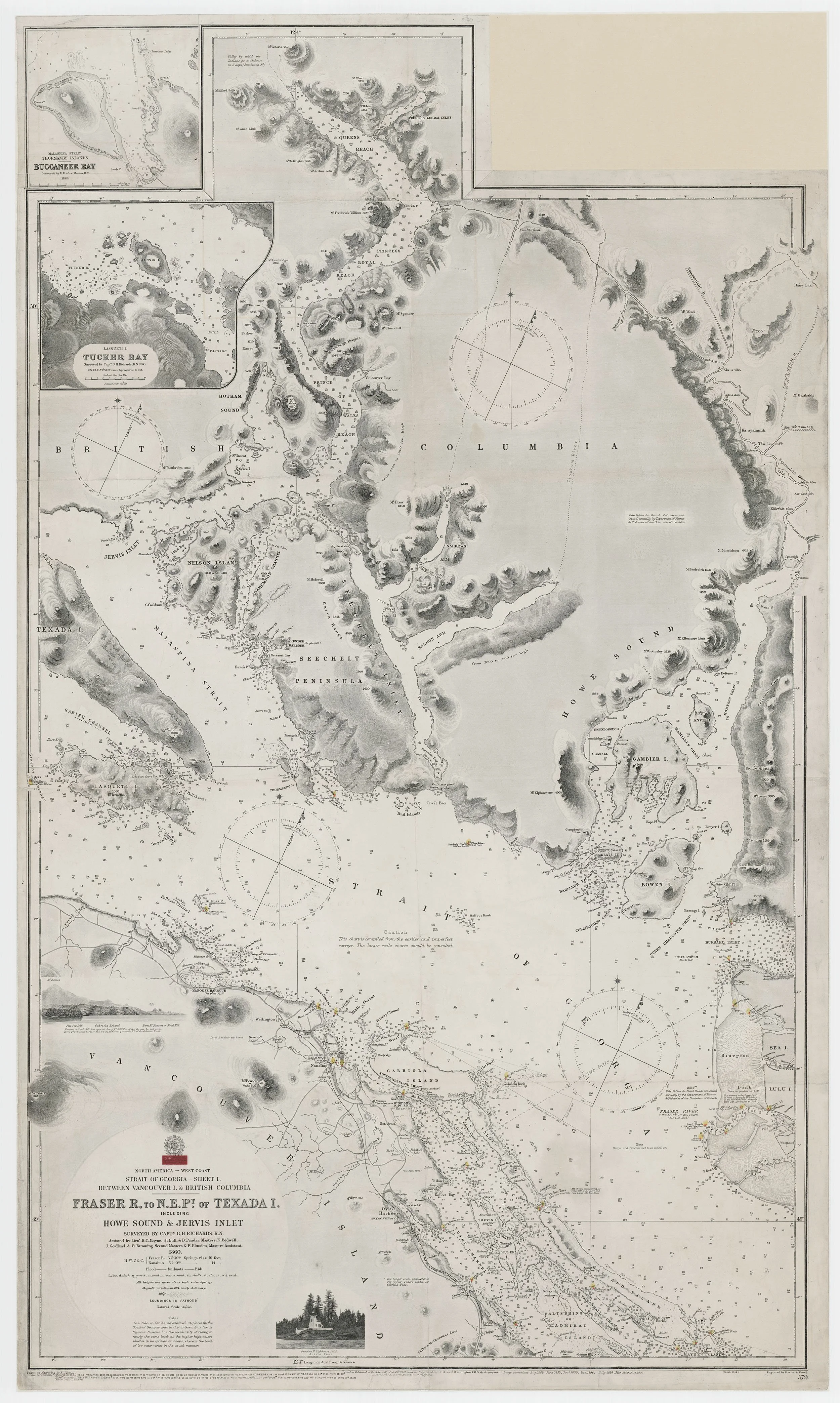
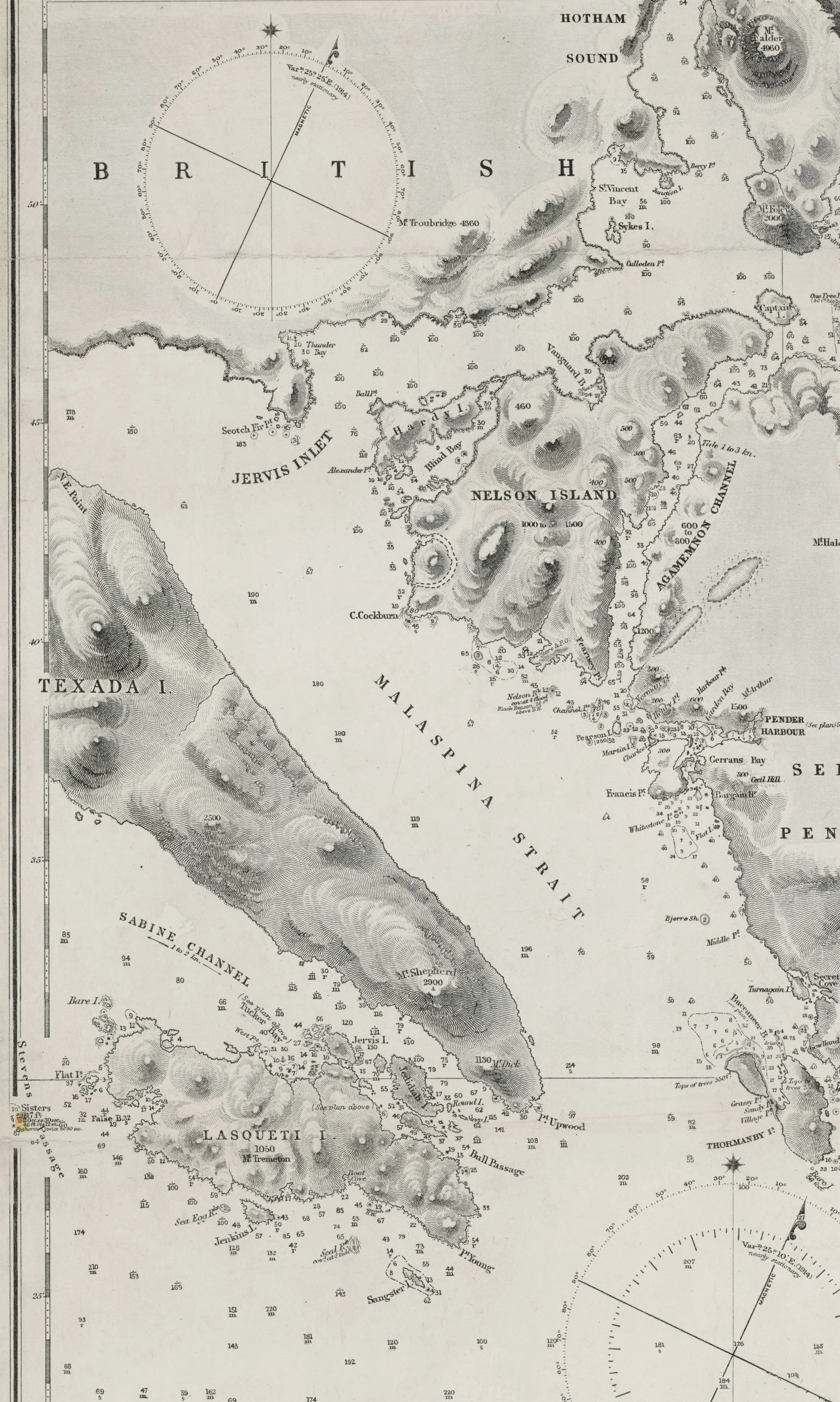
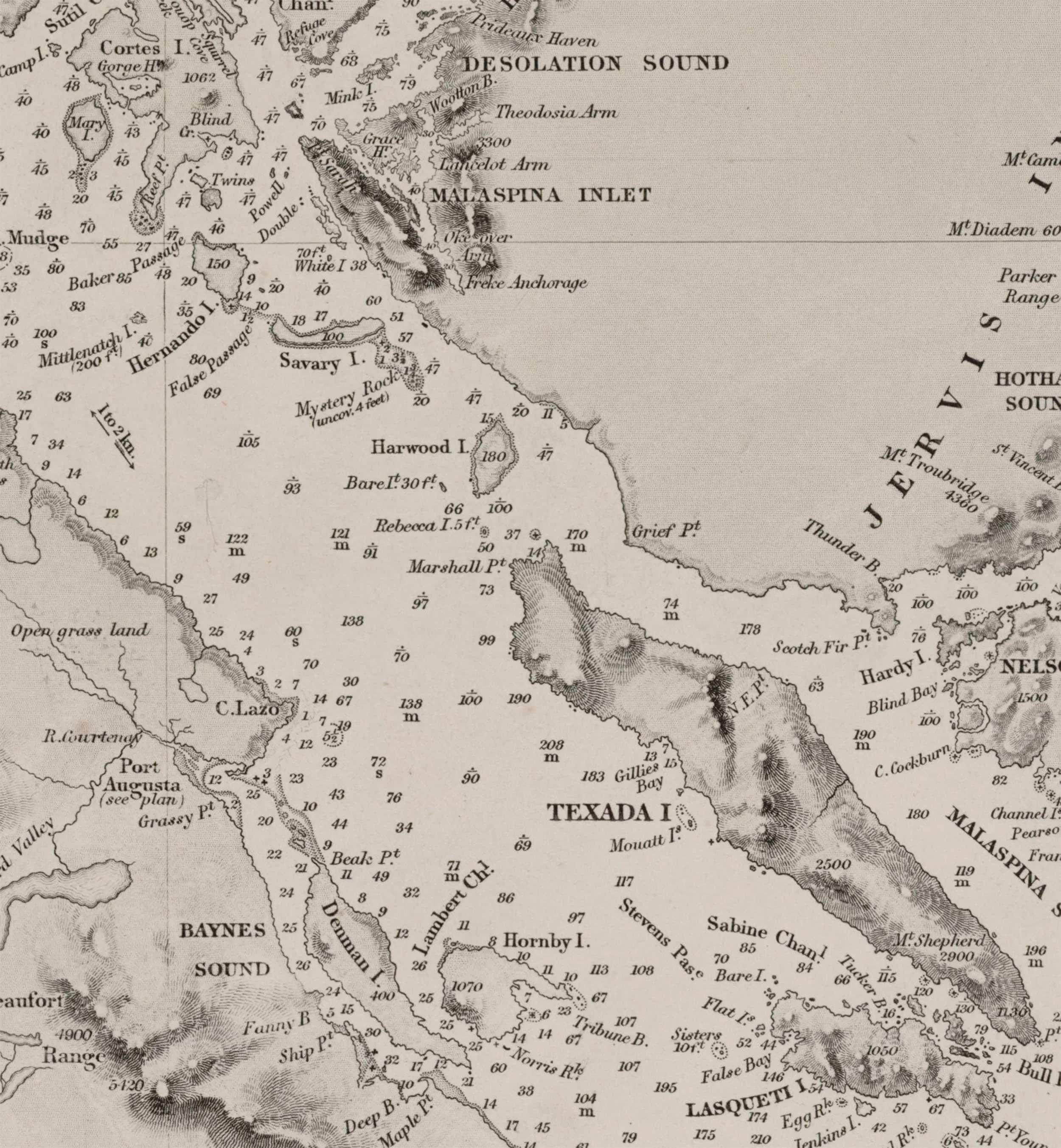
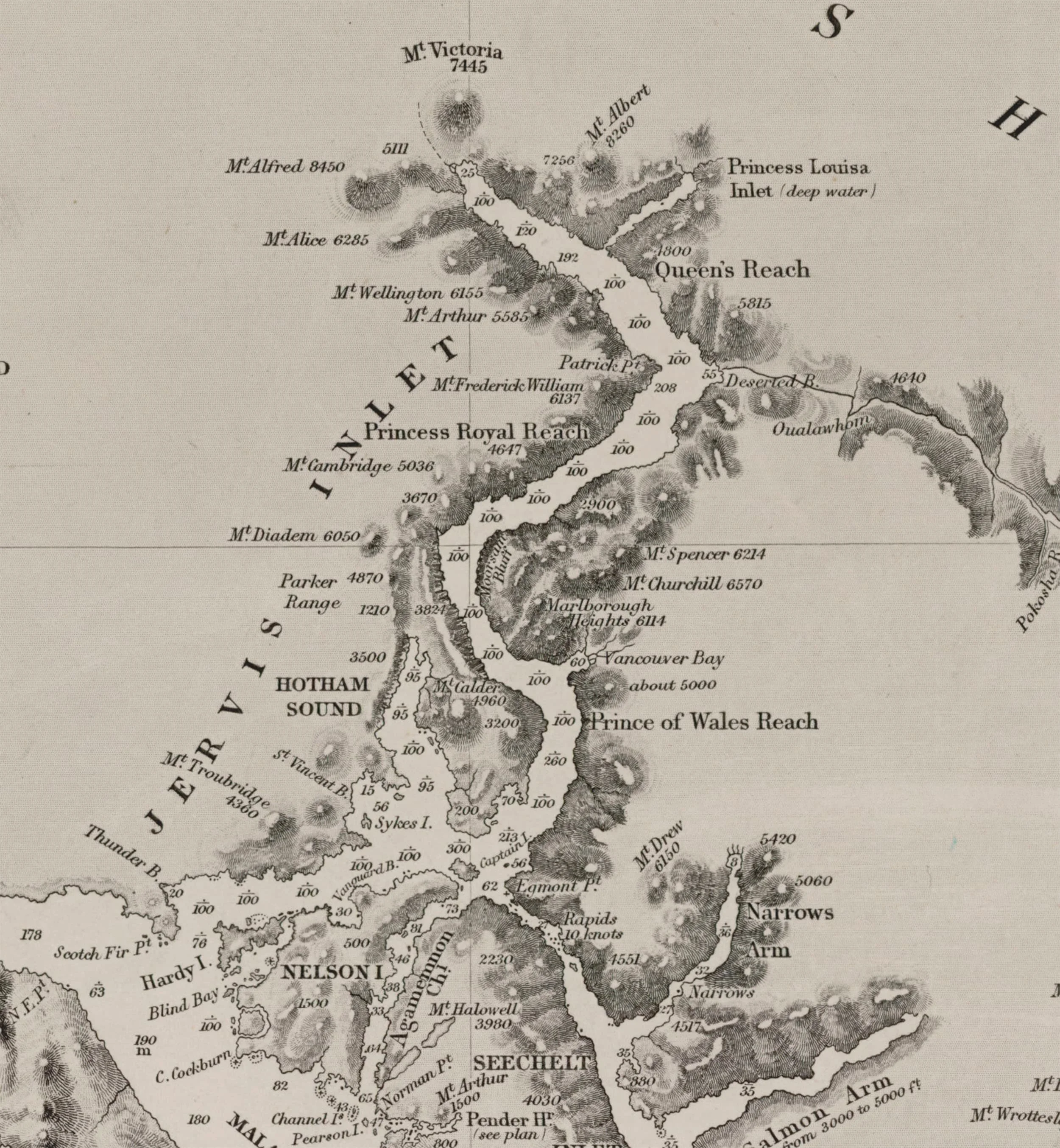
In 1860 Richard’s work began in earnest. Between February and November of that year he completed surveys of over forty locations around Vancouver Island and the Strait of Georgia ¹⁵. Richards produced an incredible amount of information about the coast, almost all of which was sent to Edward Powell at the Hydrographic Office. Richard’s first sighting of the Sunshine Coast was in June 1860, when he completed surveys of Lasquiti, the southern half of Texada, Sechelt, Nelson Island, Scotch Fir point, and Frolander bay ¹⁶⸴¹⁷. Edward Powell used this survey, along with others of Jarvis Inlet, Howe sound, and the East coast of Vancouver Island to produce Chart 579 ¹⁷.
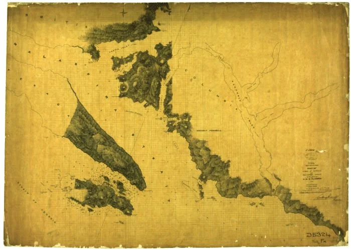
Draft Chart of Lasquiti, Texada, and Pender Harbour, Drawn on HMS Hecate 1860
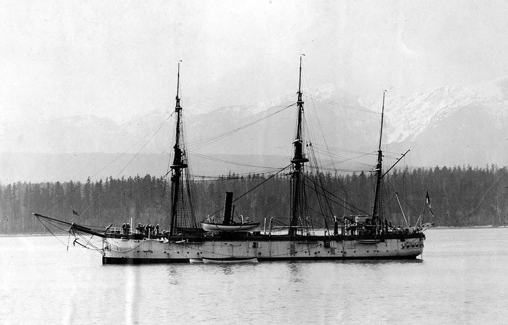
By the end of 1860 it was apparent that the Plumper was insufficient for the task of hydrographic surveys. Richards was given command of the HMS Hecate (pronounced Heck-a-tee), and the majority of the crew transferred with him. The Hecate was a paddle wheel sloop, twice the length of the previous ship ¹⁴⸴¹⁸.
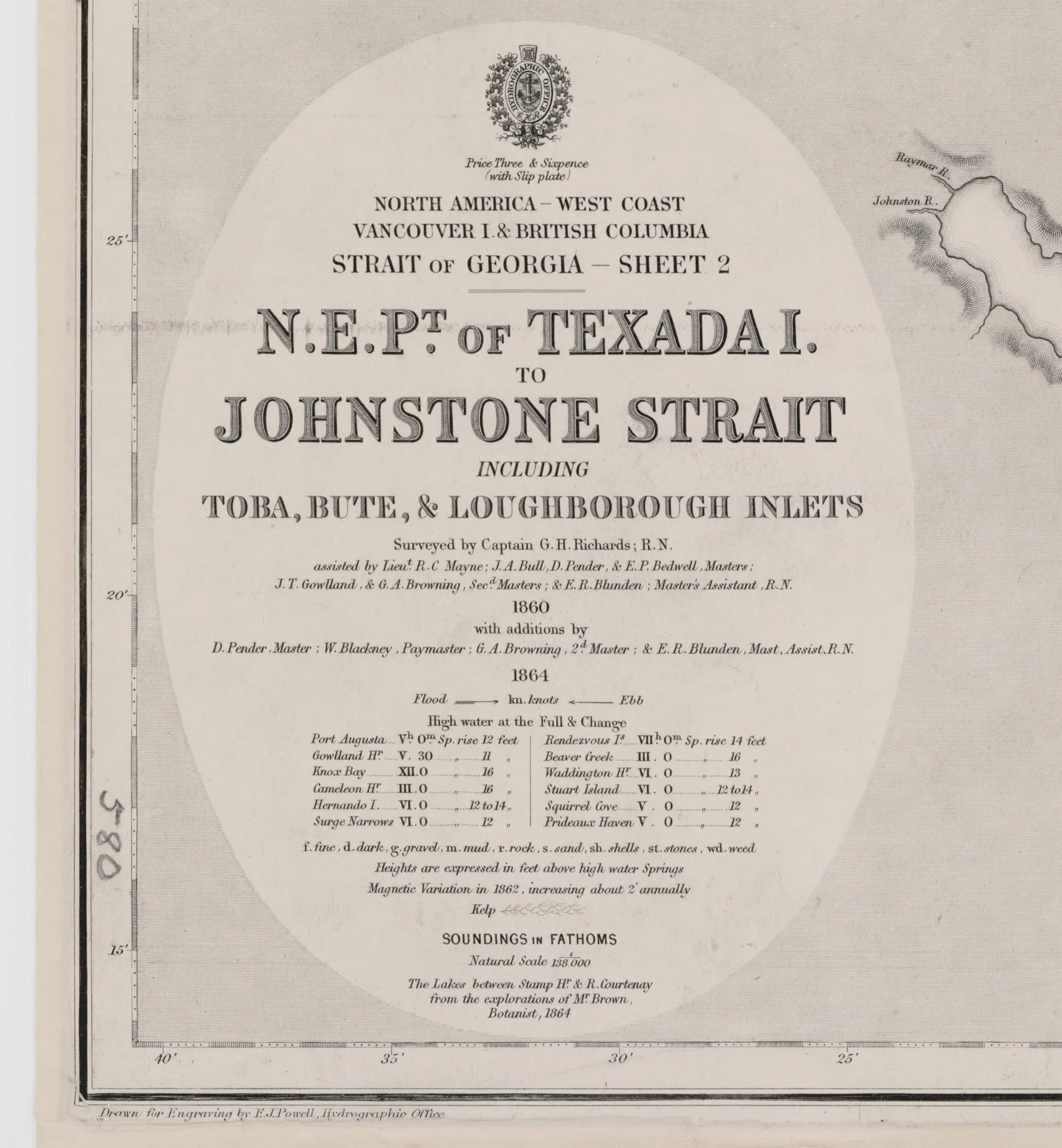
Throughout 1861 and 1862 Richards worked ceaselessly to complete a comprehensive survey of British Columbia, and working together with Edward Powell, produced dozens of charts that resolved the coastline of BC for the first time, and gave sailors critical information to avoid hazardous areas ¹⁵⸴¹⁷. Richard’s work was also compiled into the ‘Vancouver Island Pilot’, published in two editions by the Hydrographic Office, the first in 1861, and the second in 1864 ¹⁸.
HMS Hecate in Esquimalt Harbour, watercolour by Edward Bedwell.
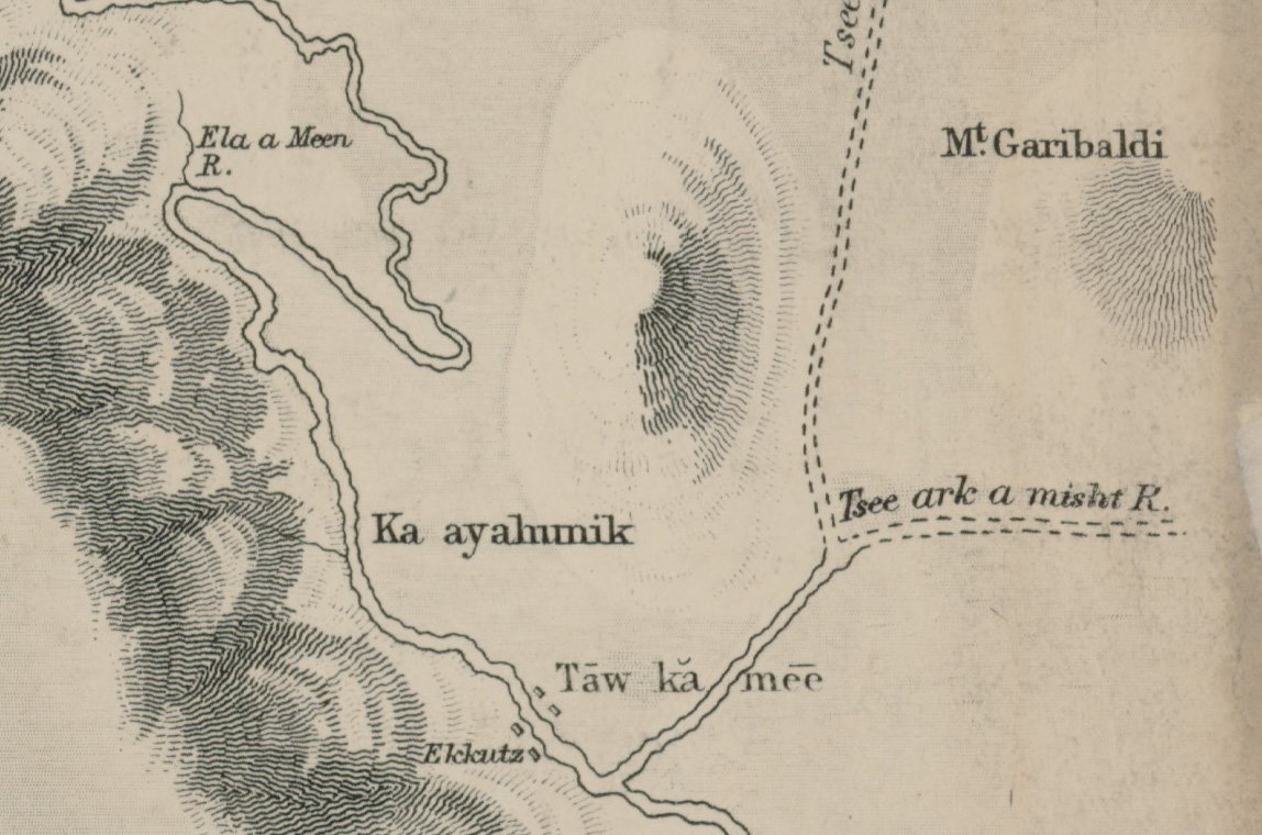
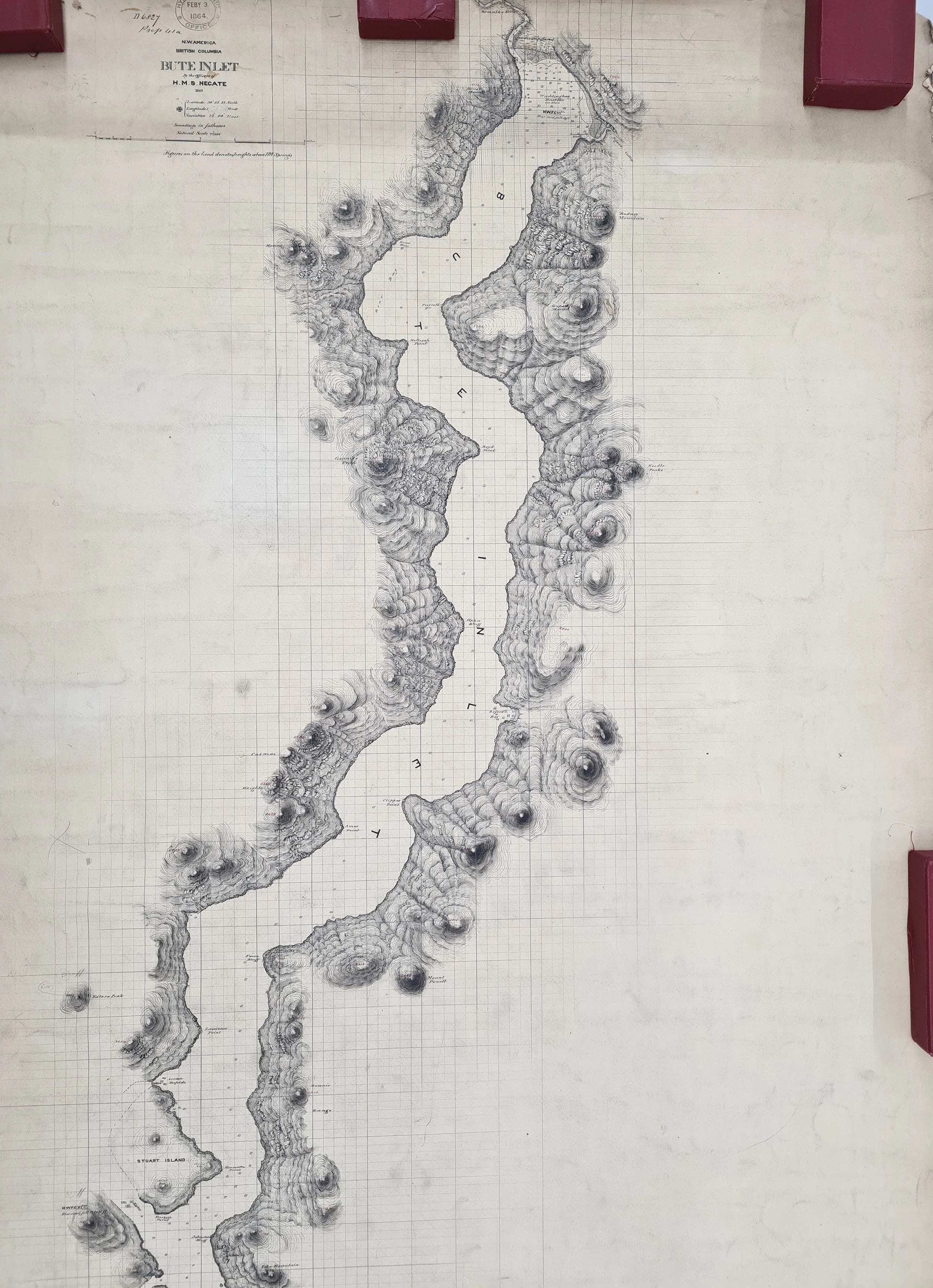
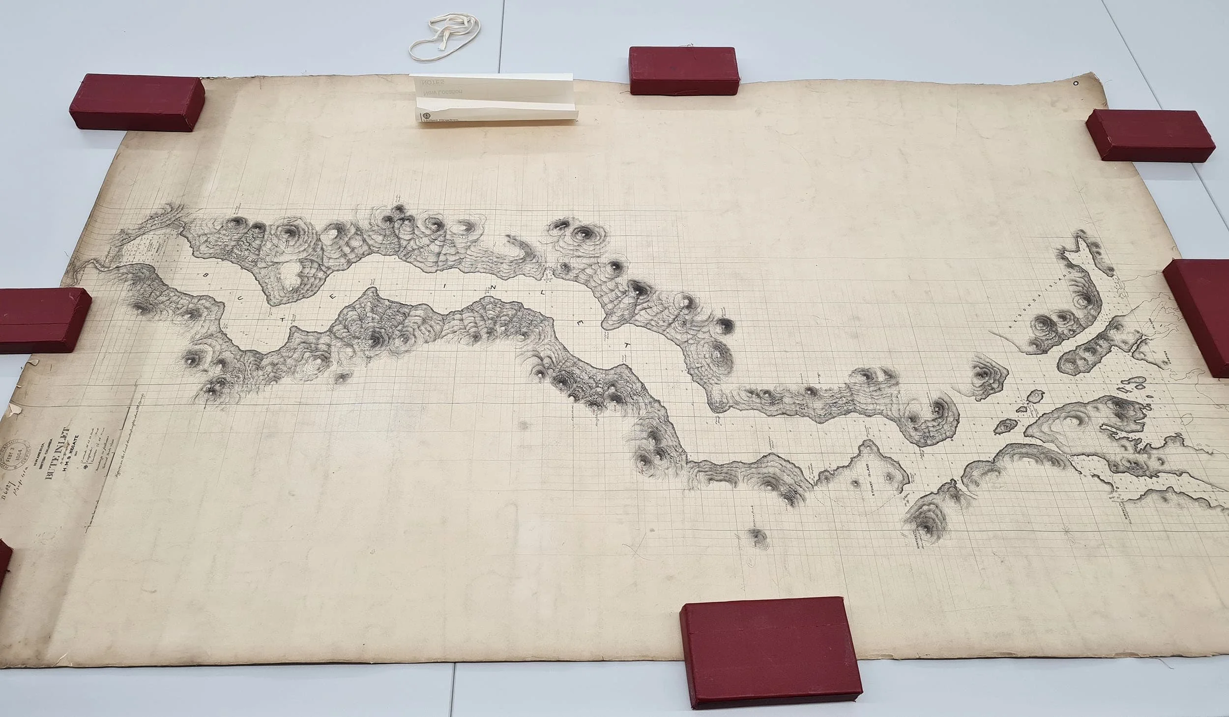
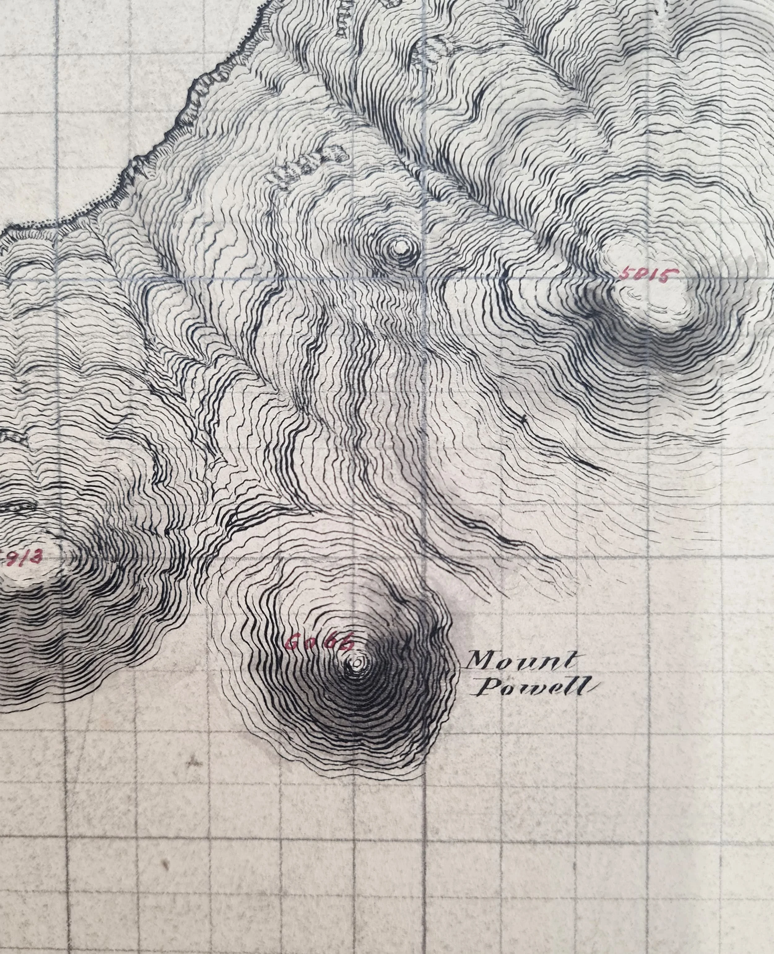
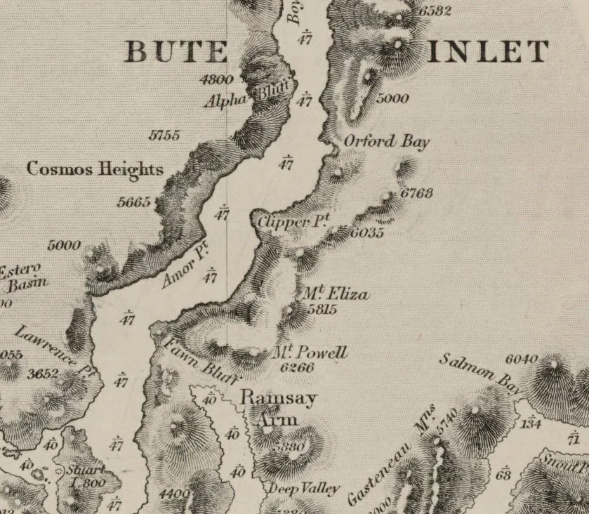
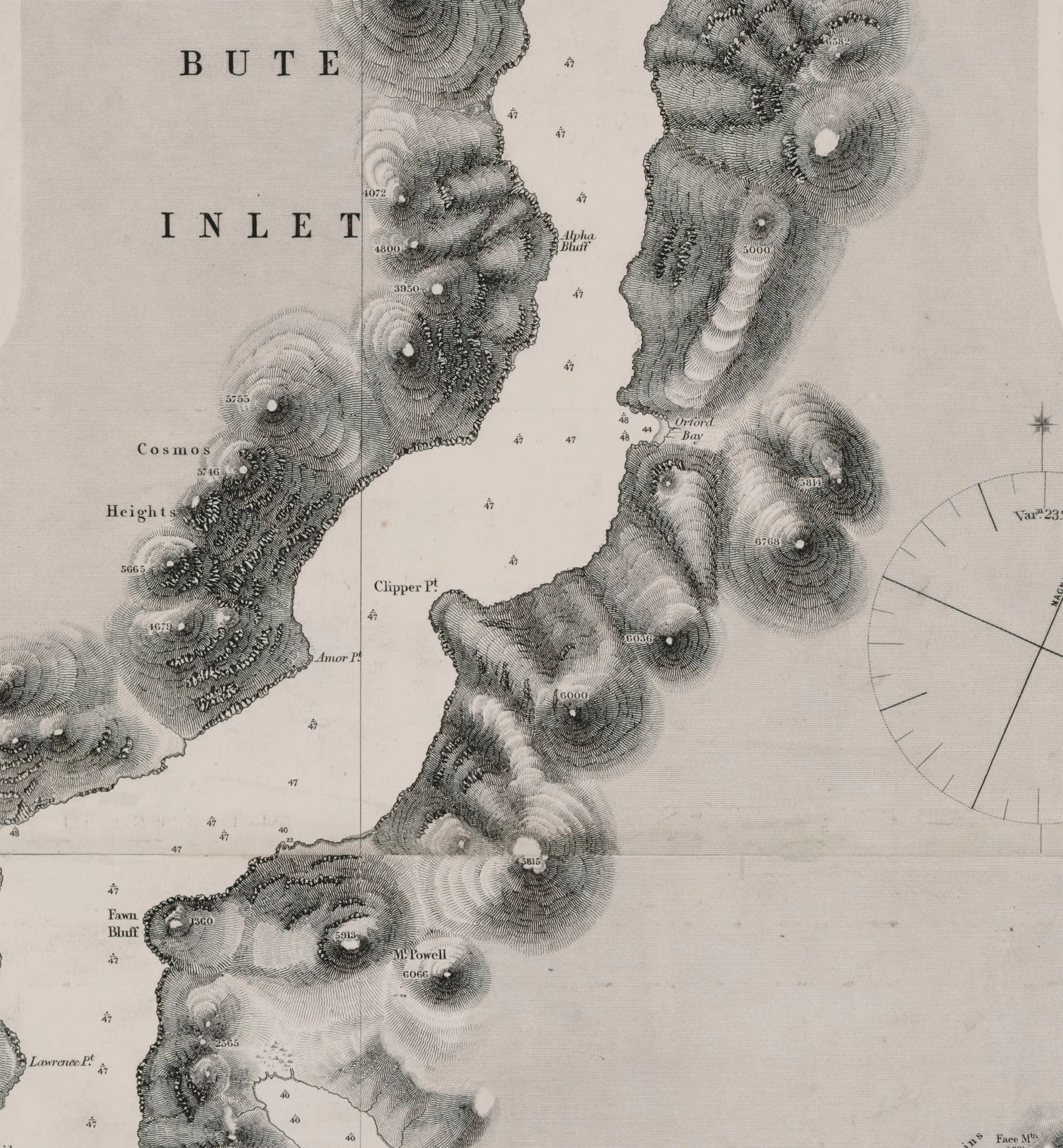
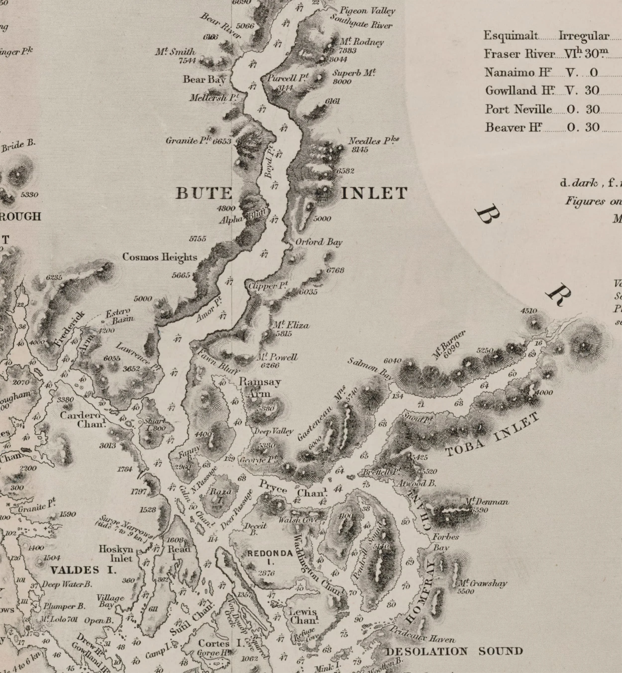
The first connection between Edward Powell and Powell River was made during this time. During July and August 1862, one of the smaller ships of the Hecate, the “Shark” made a survey of Bute inlet ¹⁵. Upon returning to the Hecate, a draft chart was produced from their findings which shows the close connection between Richards and Powell. This chart names Mount Powell, on the Eastern side of Bute Inlet ²⁰⸴²¹. We can confirm that this refers to Edward Powell, as the adjacent mountain is named ‘Mount Eliza’ after Edward’s first wife ²².
To know how Edward Powell made use of this Bute Inlet Survey, we must bring another character into this story of exploration; Daniel Pender. Pender was born in Falmouth in 1832, and began his naval career as Master’s Assistant on the survey vessel HMS Acheron. The Acheron completed a survey of New Zealand in 1847, and Pender first met G.H. Richards on this voyage. Pender joined the crew of the HMS Plumper in 1856, serving as a Master and Senior Assistant Surveyor. He often worked as draughtsman, drawing the draft charts that were sent to the Hydrographic Office ⁹. In November 1860 Daniel Pender was transferred to the Hecate along with the rest of the crew, and continued to serve as Master and as a draughtsman.
Daniel Pender
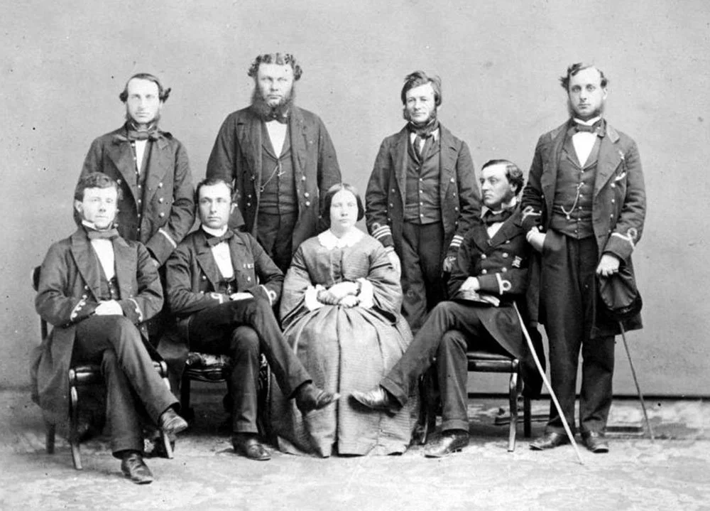
Officers of the HMS Plumper. Daniel Pender is on the right.
In December 1862, Richards was recalled to London, and left British Columbia at the end of the year on board the Hecate. On his return to England in 1864, Richards was appointed Hydrographer of the Navy, a position where he was in charge of the entire Hydrographic Office, and was Edward Powell’s direct superior ⁹. Edward Powell had been promoted to second class draughtsman in 1864, and in 1865 he was promoted to Chief Draughtsman, becoming responsible for the creation of all Admiralty Charts ⁶⸴⁷.
“The Admiralty Hydrographic Service 1795–1919” by Vice-Admiral Sir Archibald Day
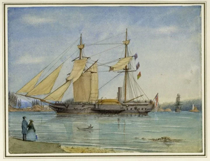
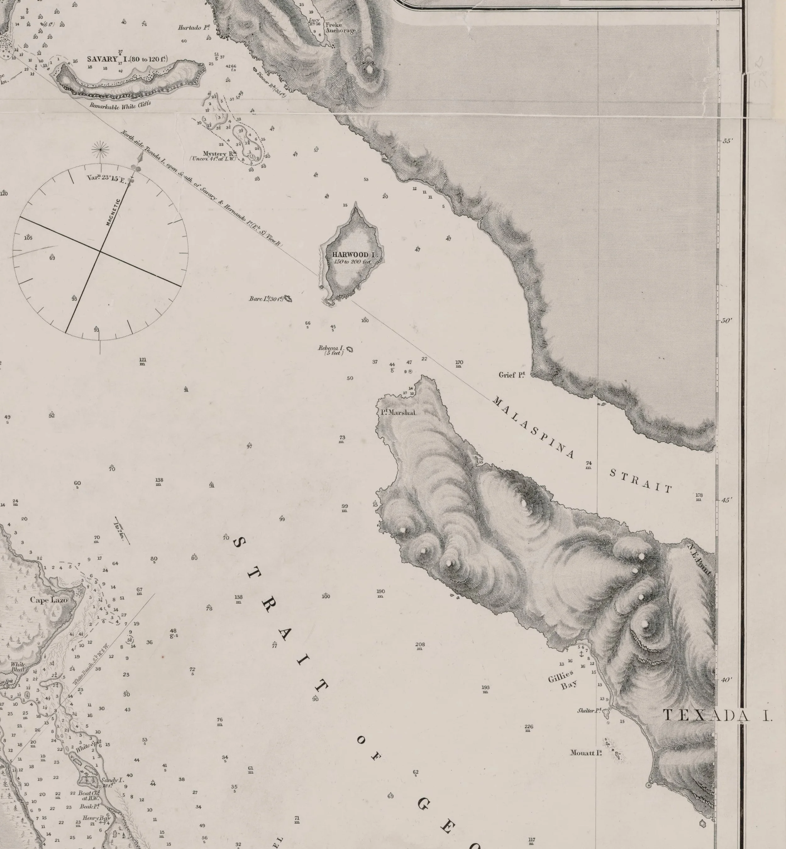
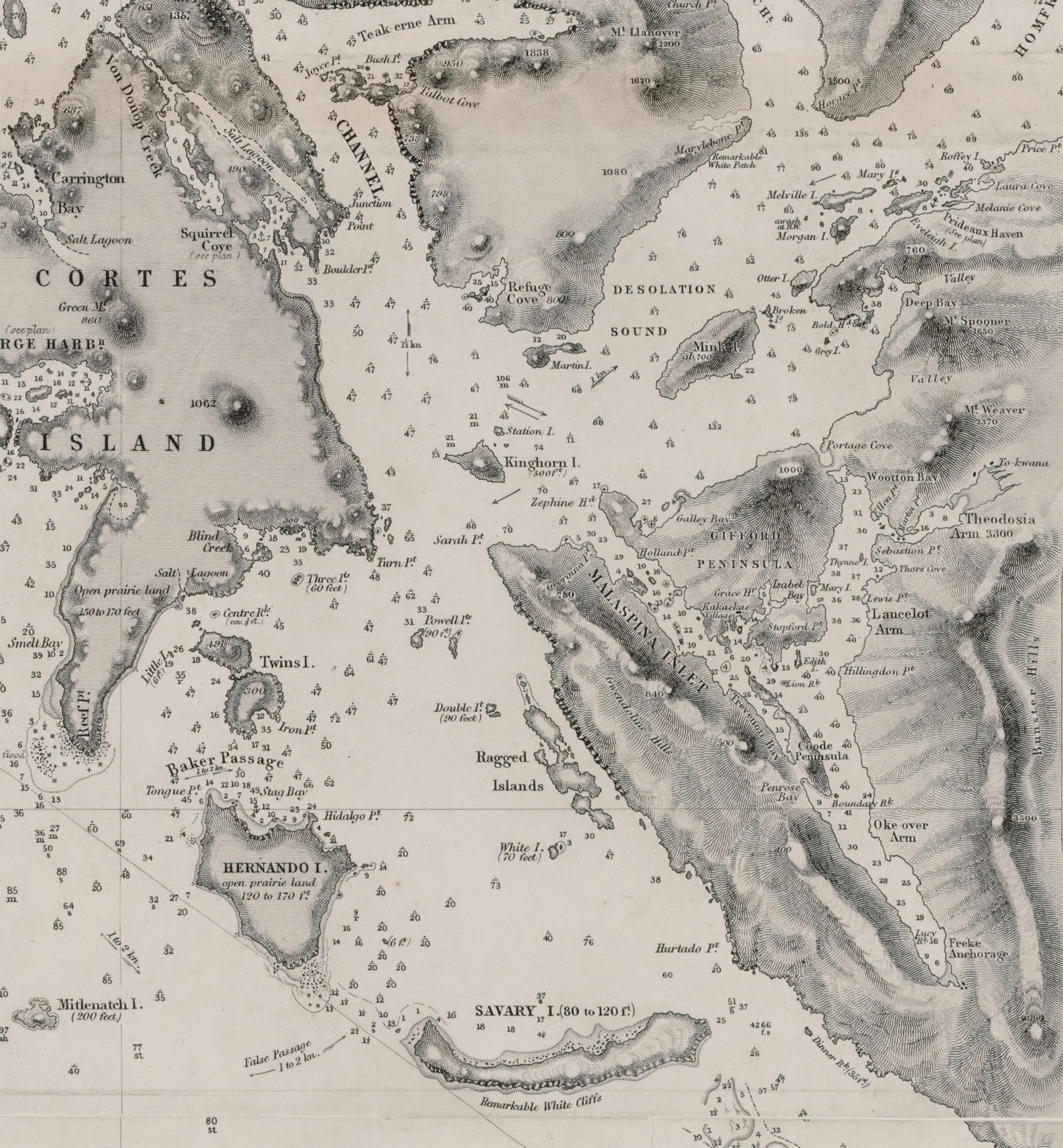
Richards had departed but the survey work was not completed. Daniel Pender was made Commander of a hired survey ship, the S.S. Beaver, and continued the work of charting the coast of B.C ¹⁴. The Beaver was the first steamship on the Pacific Northwest coast, and could sail regardless of the wind. Many of the crew of the Hecate transferred over to the Beaver. Pender was now in charge of the survey work, and in September of 1863 he surveyed Desolation Sound and Toba Inlet ²³. Immediately afterwards, in October, he surveyed Savary and Harwood Islands, and the coast North of Grief Point ²³.
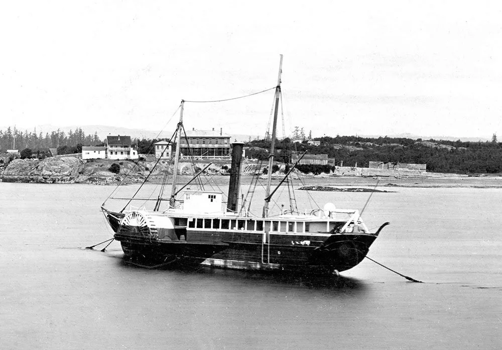
S.S. Beaver in Victoria, 1870
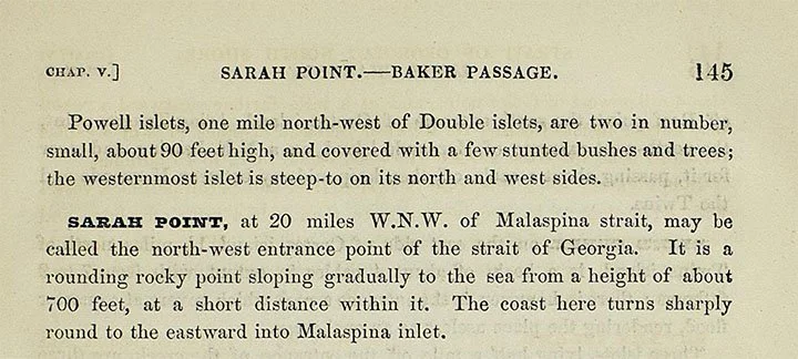
During this time another location was named after Edward Powell; the Powell Islets, located only 10 kilometers Northwest of Lund. The Powell Islets first appear in “The Vancouver Island Pilot”; drawn from the surveys conducted by Richards and Pender from 1857-1864 ¹⁹. The Pilot was published in two sequential editions, the first in 1861 and the second in 1864 ⁹. Powell Islets appears in the 1864 edition, which required Penders surveys of Desolation Sound and Savary Island to be completed.
The Powell Islets also appear on the first edition of Edward Powell’s Chart 580, published in 1865 ²⁴. We currently have an open request with the UK Hydrographic Office Archives for Pender’s documents and letters showing Powell’s name on the draft charts.
Section of Chart 580 showing Powell Islets, 1865
Passage from “The Vancouver Island Pilot” 1864
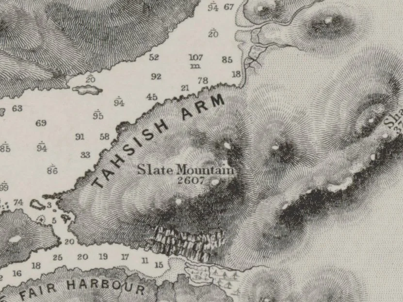
Edward Powell combined Richard’s Bute Inlet Survey of 1862 with Pender’s 1863 surveys of Toba Inlet, Desolation Sound, Savary, Harwood, and Texada to produce Chart 580 in 1864 ²⁴. This chart is the very first to accurately show the geography of our home, and it is incredibly beautiful.
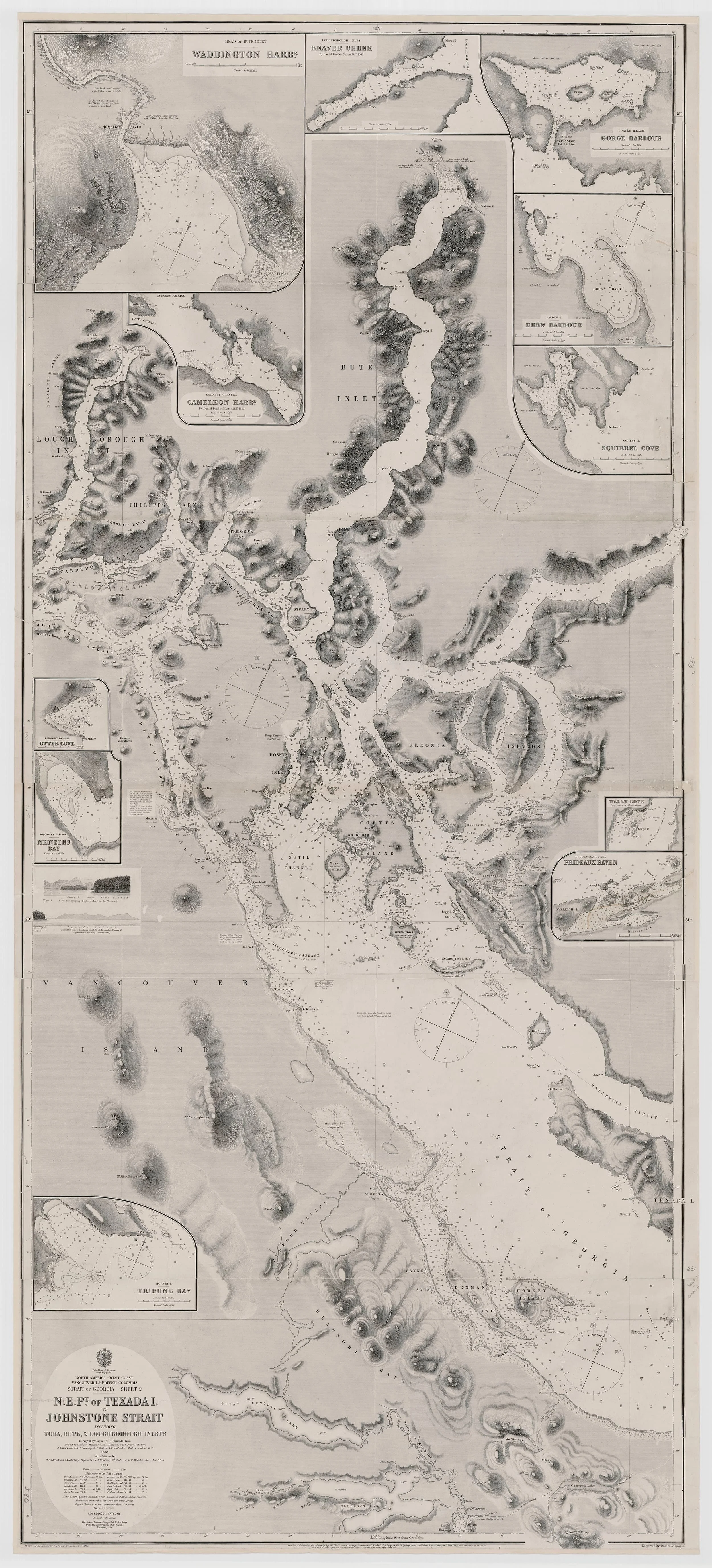
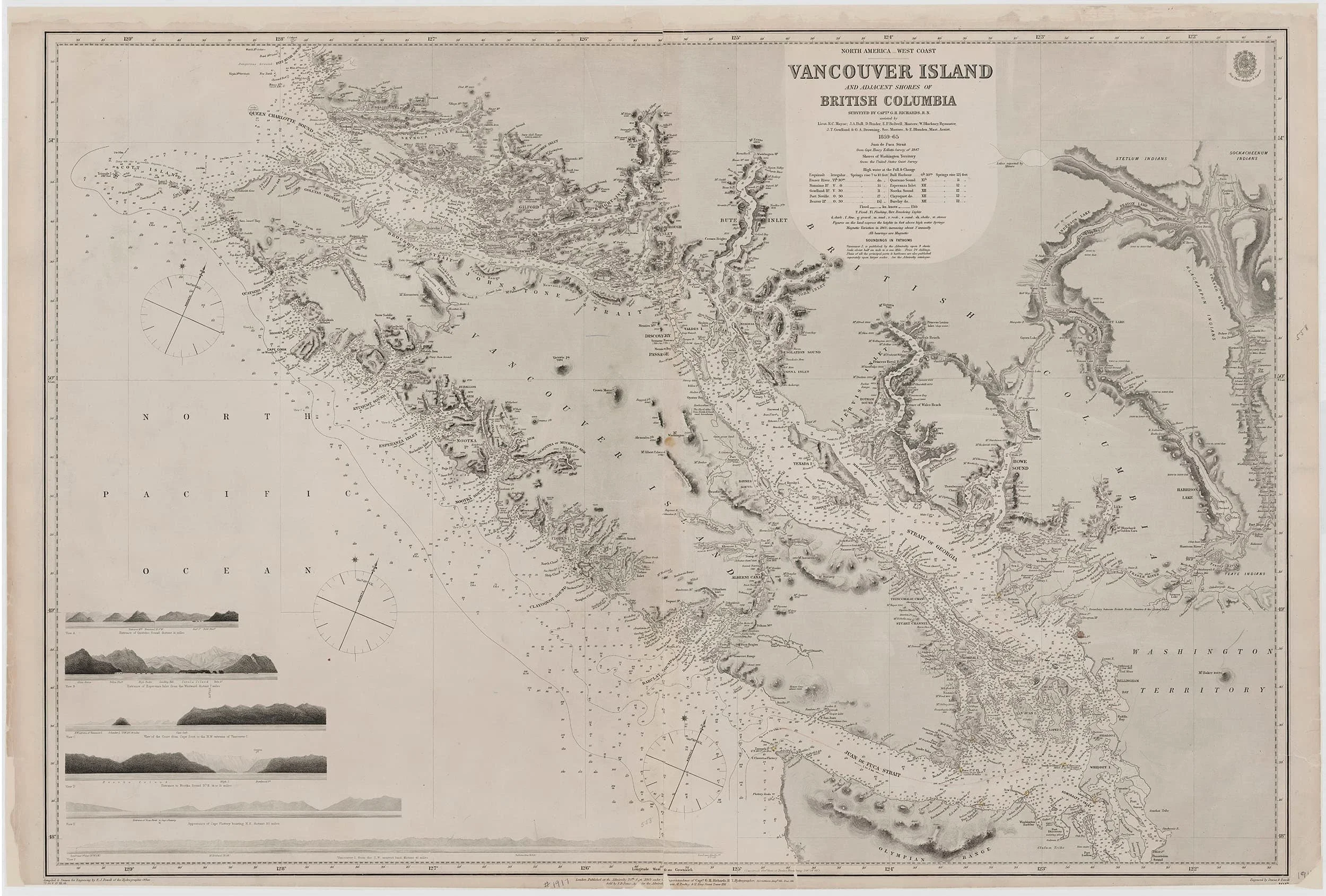
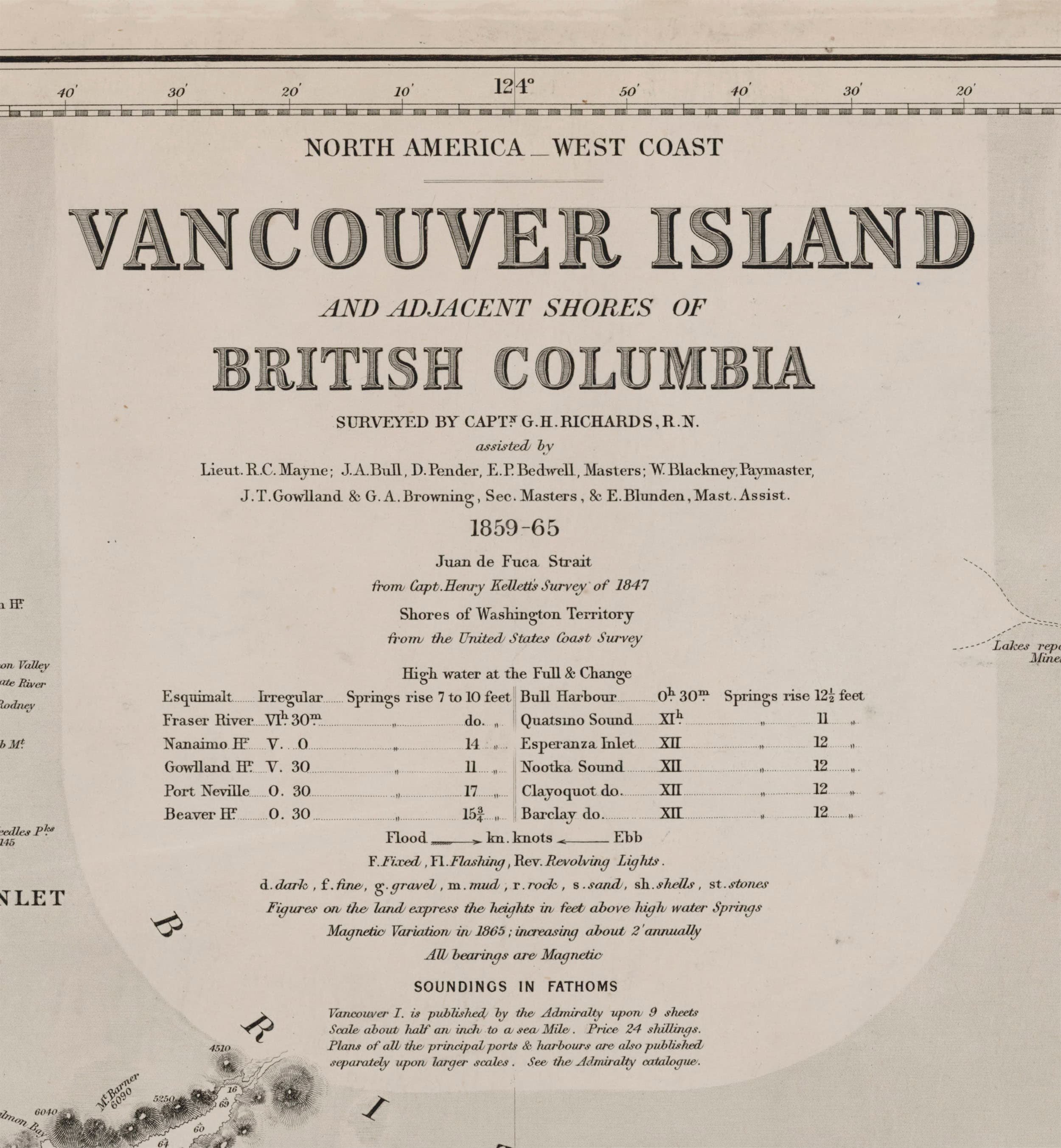
The following year, Edward collected the entire body of charts that were created from 1857 - 1864, the combined work of George Henry Richards, Daniel Pender, and the crews of the Plumper, Hecate, and Beaver. He composed these charts into Chart 1917; a vast overview detailing the totality of Vancouver Island, the Strait of Juan de Fuca, the Strait of Georgia, and the Coast of Mainland ²². Chart 1917 is the product of seven years of survey work, and thousands of hours of meticulous drawing. It is Edward James Powell’s masterpiece.
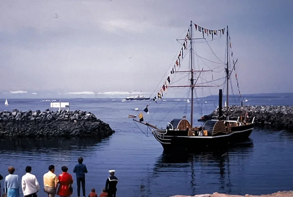
Replica of the Beaver in Westview Harbour during the Queen’s visit, 1971
After 1865, Pender continued extensive surveys until 1870, when the work was considered complete. George Henry Richards worked as Hydrographer of the Navy until 1874, and was knighted in 1877 ⁸. Throughout this time Edward Powell completed many more charts of B.C. from Pender’s surveys ²⁵, and updated existing charts with minor corrections. It may seem that this is the end of the story, but there is one more remarkable voyage that links Edward Powell to the coast of British Columbia.
In 1877, John Graham Hanmer, Commander of the HMS Daring ²⁶, was tasked with surveying the mouth of the Skeena River to determine if it was a suitable terminus for the Canadian Pacific Railway ²⁷. Upon departure from Nanaimo the Daring anchored overnight in Gillies bay on August 25th, and the following day navigated to Marshal Pt. at the North end of Texada, passed inside Harwood island, and went North to Johnstone Strait ²⁸.
Commander Hanmer of the HMS Daring
HMS Egeria, the sister ship of the HMS Daring
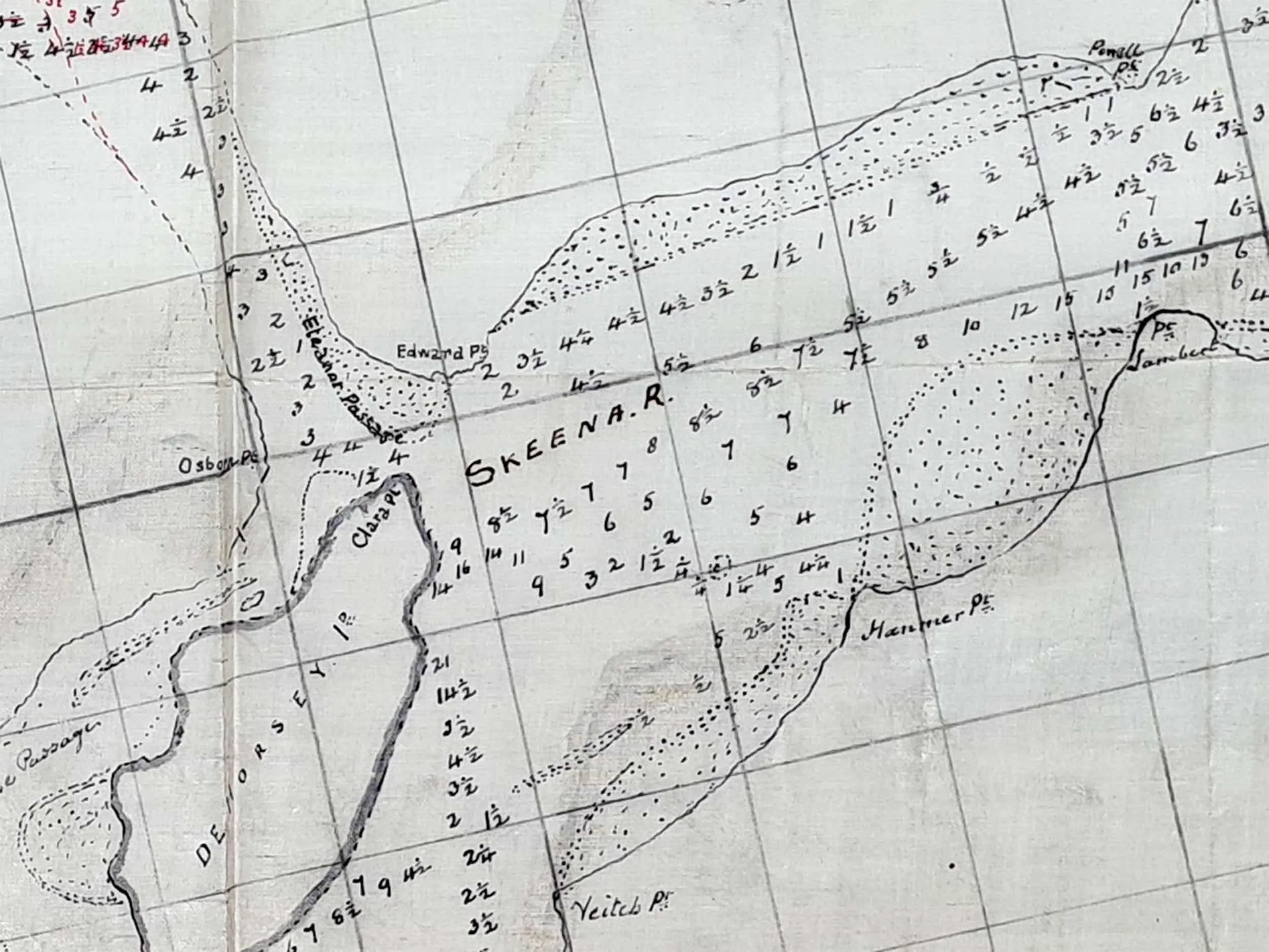
Hanmer arrived at the mouth of the Skeena River in September. He made a draft chart of the area, and on that chart appears the following place names ²⁹:
Edward Point, Powell Point, Clara Point, Osborn Point, and Eleanor Passage.
These locations are named after Edward Powell, his second wife, Clara Osborn, and their Daughter, Eleanor ³⁰. It is curious to notice that the names of Captain Hanmer, Navigation Lieutenant Veitch, and Sub Lieutenant Hegan are given to locations directly across from Powell Point.
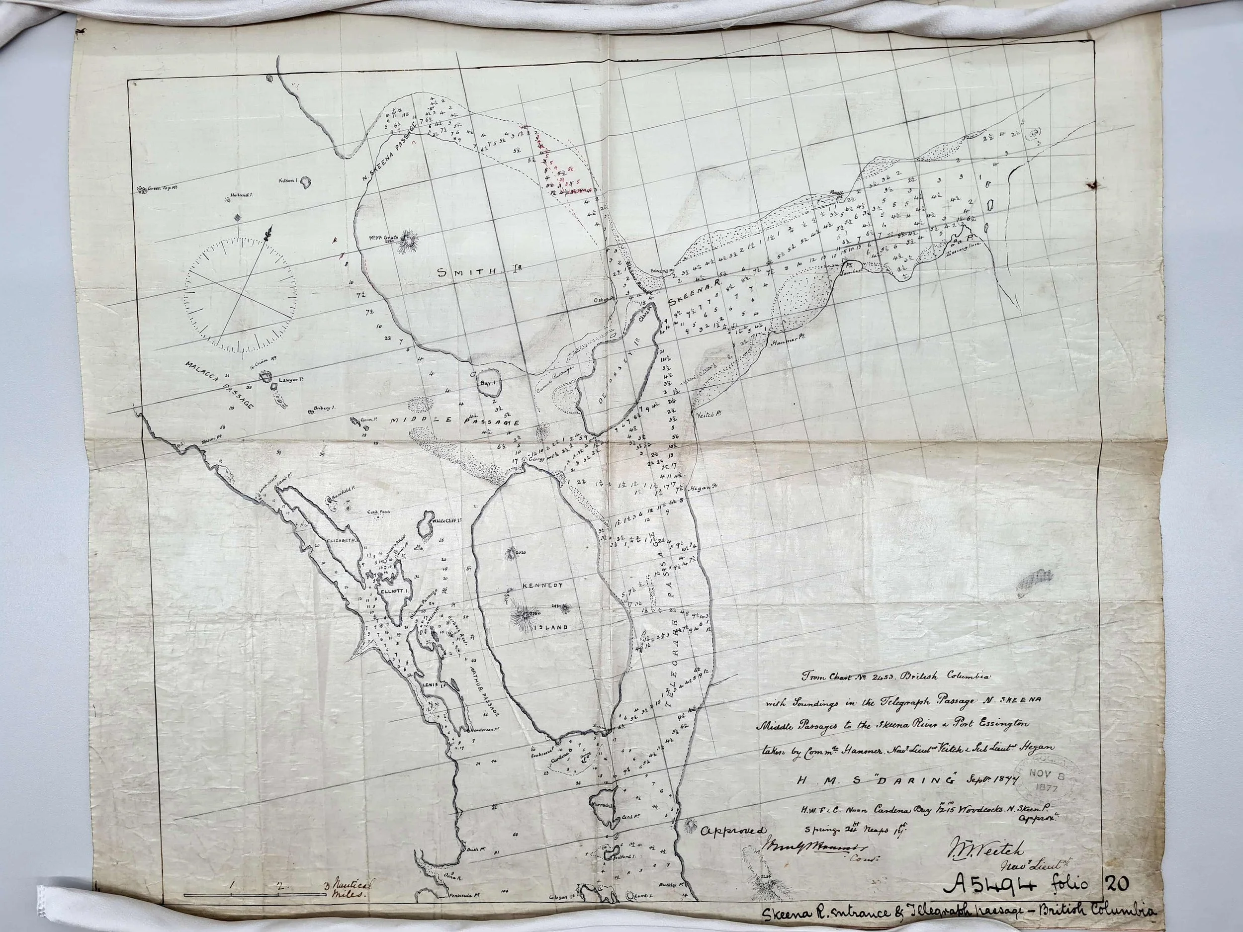
The most remarkable thing is that this chart was made in September 1877, before Eleanor Powell was born on December 15th, 1877 ³¹. This is a mysterious sequence of events; perhaps Eleanor’s name was added later to the chart, or perhaps her name was chosen before her birth and Hanmer knew of it.
John Hanmer must have been very close with Edward Powell to have known the details of his family life, and must have held him in high regard to honor him, his wife and daughter with these names, especially since Hanmer was not regularly a surveyor ²⁶.
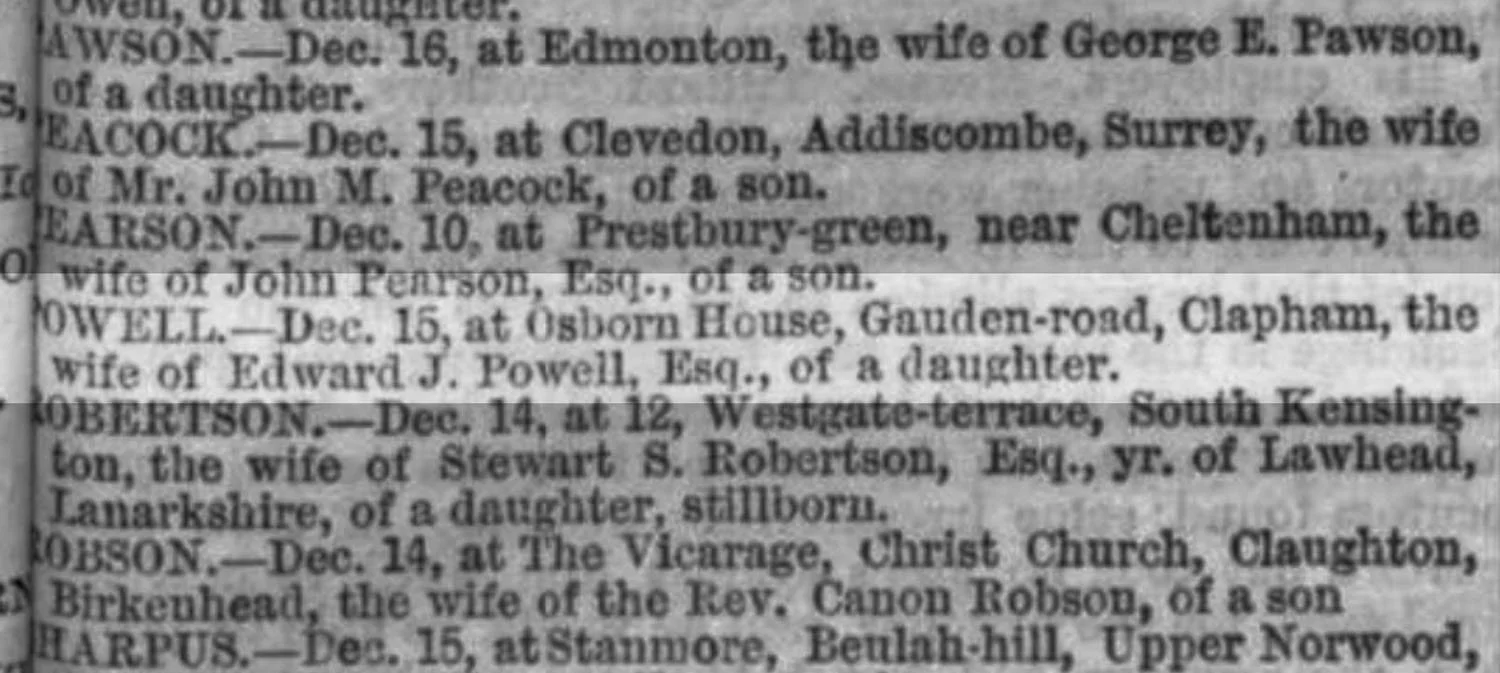
Birth notice for Eleanor Osborn Powell, London Evening Standard, December 1877
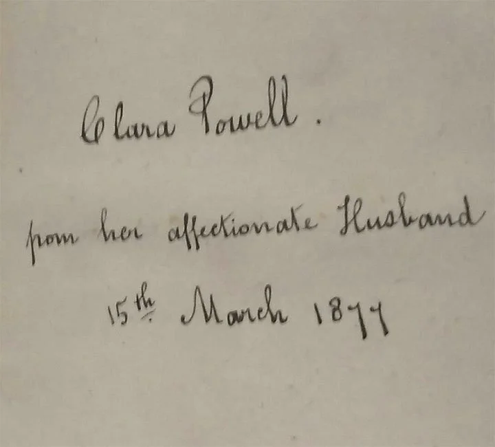
Inscription to Clara Powell from Edward
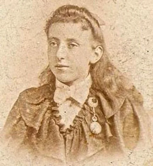
Eleanor Osborn Powell, by W.P. Marsh
As far as we can tell, this is the end of the story. After 1877, Edward Powell continued working as chief draughtsman until he retired in 1892. He died in 1903 at the age of 76 ²⸴⁶, and left a cartographic legacy that shaped the world.
Edward Powell was a cartographer and an artist. He was the first to reveal the geography of British Columbia, and his work touched the lives of hundreds of thousands of people, guided innumerable voyages along our coast, and changed the course of British Columbia’s history. He is a perfect fit to be the namesake of Powell River.
References
“Edward James Powell”. London, England, Church of England Births and Baptisms, 1813-1924. Ancestry.com
Laurence Worms and Ashley Baynton-Williams, British Map Engravers: A Dictionary of Engravers, Lithographers, and Their Principal Employers to 1850. (Rare Book Society, 2011).
Mary Irish, email message to author, February 2nd, 2026.
"1851 Great Exhibition: Official Catalogue: Class V.: Edward James Powell". Grace's Guide To British Industrial History, accessed April 20th, 2026.
Halifax Harbour [cartographic material] / surveyed by Captn. H.W. Bayfield R.N. F.A.S., 1853. Reference: R11630-1313-4-E, Maps and cartographic material, Canadian Archives.
https://recherche-collection-search.bac-lac.gc.ca/eng/Home/Record?app=fonandcol&IdNumber=3670501&q_type_1=q&q_1=3670501&ecopy=e010694086Archibald Day, The Admiralty Hydrographic Service, 1795-1919. (Her Majesty's Stationery Office, 1967).
Llewellyn Styles Dawson, Memoirs of hydrography: including brief biographies of the principal officers who have served in H.M. Naval Surveying Service between the years 1750 and 1885. (The Imperial Library, 1885).
Helen B. Akrigg, Richards, Sir George Henry, Dictionary of Canadian Biography, vol. 12, University of Toronto/Université Laval, 2003, accessed April 20, 2026.
https://www.biographi.ca/en/bio/richards_george_henry_12E.htmlLinda Batchelor, ‘A very nice middy’ – Daniel Pender 1832-1891. National Maritime Museum, Cornwall. accessed April 20th, 2026.
https://www.maritimeviews.co.uk/focus-on-falmouth/a-very-nice-middy-daniel-pender-1832-1901/George S. Ritchie, The Admiralty chart British naval hydrography in the nineteenth century. (Hollis & Carter, 1967)
Haro and Rosario Straits [B.C.] [cartographic material] / surveyed by Captn. G. H. Richards, & the Officers of H.M.S. Plumber, 1858-9. Reference: R11630-2906-3-E, Box number: 2000358225, Maps and cartographic material, Canadian Archives.
https://recherche-collection-search.bac-lac.gc.ca/eng/Home/Record?app=fonandcol&IdNumber=3673984&q_type_1=q&q_1=haro&ecopy=e010700495Vancouver Island. Victoria Harbour [cartographic material] / surveyed by Captn. G.H. Richards & the Officers of H.M.S. 'Plumper', 1859. Reference: R11630-2672-4-E, Box number: 2000697546, Maps and cartographic material, Canadian Archives.
https://recherche-collection-search.bac-lac.gc.ca/eng/Home/Record?app=fonandcol&IdNumber=3673599&q_type_1=q&q_1=victoria&ecopy=e010762056Crawford Kilian, Where Are the Statues of Captain Richards?. (The Tyee, 2012)
https://thetyee.ca/Books/2012/07/14/Captain-Richards/Barry Gough, Review: The Private Journal of Captain G. H. Richards: The Vancouver Island Survey (1860-1862). (BC Studies, 2013) accessed April 20th, 2026.
https://bcstudies.com/book_film_review/the-private-journal-of-captain-g-h-richards-the-vancouver-island-survey-1860-1862/Linda Dorricott and Deidre Cullon, The private journal of Captain G.H. Richards: the Vancouver Island survey (1860-1862). (Ronsdale Press, 2012).
Gary Little, Capt. George Henry Richards: 1860 Sunshine Coast Survey. (Harbour Spiel, September 2010). https://www.garylittle.ca/maps-historic/richards/richards-spiel-201009.pdf
British Columbia, Fraser R, to N.E.Pt. of Texada I. [cartographic material] : including Howe Sound & Jervis Inlet / surveyed by Captn. G.H. Richards, R.N., assisted by Lieut. R.C. Mayne, J. Bull, D. Pender, & E. Bedwell, Masters; J. Gowlland, & G. Browning Second Masters; & E. Blunden Masters' Assistant, 1860. R11630-2514-8-E, Box number: 2000696907, Maps and cartographic material, Canadian Archives.
https://recherche-collection-search.bac-lac.gc.ca/eng/Home/Record?app=fonandcol&IdNumber=3673259&ecopy=e010761301The Colonial Despatches, HMS Hecate, 1839-1865. (BC Genesis, 2025)
https://bcgenesis.uvic.ca/hecate.htmlGeorge Henry Richards, The Vancouver Island pilot: containing sailing directions for the coasts of Vancouver Island, and part of British Columbia : compiled from the surveys made by Captain George Henry Richards, R.N., in H.M. ships Plumper and Hecate, between the years 1858 and 1864. (The Hydrographic Office, Admiralty, 1864).
British Columbia - Bute Inlet, 3 Feb 1864. SVY/4/D6827, Hydrographic Survey indexes and incoming data Book 4: Surveys. United Kingdom Hydrographic Office Archive.
https://archive.ukho.gov.uk/records/SVY/4/D6827Karen Powell, email message to author, February 23rd, 2026.
Vancouver Island and adjacent shores of British Columbia [cartographic material] / surveyed by Captn. G.H. Richards R.N.; assisted by Lieut. R.C. Mayne, J.A. Bull, D. Pender, E.P. Bedwell, Masters; J.T. Gowlland & G.A. Browning, Sec. Masters; & E. Blunden, Mast. Assist., 1859-64. R11630-2827-7-E, Volume number: 2000358109, Maps and cartographic material, Canadian Archives.
https://recherche-collection-search.bac-lac.gc.ca/eng/Home/Record?app=fonandcol&IdNumber=3673850&ecopy=e010675454Name of Surveyor or Description: Pender, 1862-1866. SL/56, Incoming Surveying Officers' Letters. United Kingdom Hydrographic Office Archive.
https://archive.ukho.gov.uk/records/SL/56Strait of Georgia - sheet 2. N.E. pt. of Texada I. to Johnstone Strait including Toba, Bute & Loughborough Inlets [cartographic material] / surveyed by Captain G.H. Richards R.N.; assisted by Lieut. R.C. Mayne, J.A. Bull, D. Pender & E.P. Bedwell, Masters, J. T. Gowlland & G.A. Browning, Secd. Masters & E.R. Blunden, Master's Assistant R.N., 1860. R11630-2540-9-E, Box number: 2000696923, Maps and cartographic material, Canadian Archives.
https://recherche-collection-search.bac-lac.gc.ca/eng/Home/Record?app=fonandcol&IdNumber=3673346&ecopy=e010697958Name: Pender, Daniel R. Date: 1865-1880. Collection Search, Maps and cartographic material, Canadian Archives.
https://recherche-collection-search.bac-lac.gc.ca/eng/Home/Result?DataSource=Archives|FonAndCol&DateBucket=%7C1865-1880&SearchIn_1=Name&SearchInText_1=Pender%2C%20Daniel%20R&DataSourceSel=Archives&ST=SAD&"John Graham Job Hanmer R.N." The Victorian Royal Navy, accessed April 20th, 2026.
https://www.pdavis.nl/ShowBiog.php?id=1778"Return to an address of the House of Commons, dated 18th February 1878;--for a copy of any reports in possession of the government, made in 1877, by Admiral de Horsey, respecting the port or ports most suitable for a terminus of the Canadian Pacific Railway in British Columbia, with a copy of any correspondence respecting the same with the imperial government". (Department of the Secretary of State, Canada 1878)
https://open.library.ubc.ca/collections/bcbooks/items/1.0221759“HMS Daring Ships Log”. ADM 53/11039. Records of the Admiralty, Naval Forces, Royal Marines, Coastguard, and related bodies. United Kingdom National Archives.
https://discovery.nationalarchives.gov.uk/details/r/C1467450“North Skeena entrance, Nov 1877”. SVY/5/A5495, Hydrographic Survey indexes and incoming data: Book 5: Surveys. United Kingdom Hydrographic Office Archive.
https://archive.ukho.gov.uk/records/SVY/5/A5495 SVY/5/A5495“London 1881 Census: Edward James Powell”. UK Census Online.
"Births". London Evening Standard No. 16,662. December 18th, 1877, Page 1.